Best places to stay near Girraween National Park
Between Girraween National Park’s 12 walking trails and the Granite Belt’s 50 plus cellar doors, you’ll soon see this region gives you plenty of ways to fill your itinerary.

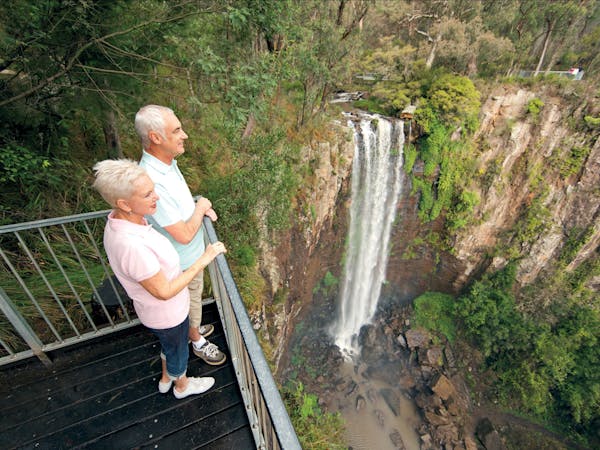
Take a leisurely stroll through changing forests to the top, and then the base, of spectacular Queen Mary Falls.
From the Queen Mary Falls picnic area, head along a fragrant eucalypt-topped ridgeline to the lush, rainforested gorge.
At the lookout, watch Spring Creek plunge 40 metres over the falls to the valley floor. Marvel at the rainbows created by the waterfall’s sheer mist, and watch as the creek continues its twisting journey along the valley, to join the Condamine River’s upper reaches.
Continue along the track to the valley floor and cool off in the waterfall’s misty spray—perfect on a hot summer's day.
Park Rangers suggest walking the circuit in a clockwise direction as it is easier on the legs! Take care on the causeway as the surface can become slippery when wet. Do not attempt to cross when in flood or if water covers the causeway.
This park is part of the Gondwana Rainforests of Australia World Heritage Area and this walk is managed by the Queensland Parks and Wildlife Service. The map only shows an indicative start point; the track route and endpoint are not shown, and the map cannot be used for navigation purposes. See www.des.qld.gov.au for detailed maps and the latest park information. When you are in the park, read the signs at and near the start of the track.


Subscribe now to receive a free downloadable Country Drive Bingo template, and let us share our specially curated holiday tips, news and deals.


Southern Queensland Country Tourism acknowledges the Traditional Custodians of the lands and waterways that run through these regions. We pay our respects to Aboriginal and Torres Strait Islander Elders past, present and emerging.
Subscribe now to receive a free downloadable Country Drive Bingo template, and let us share our specially curated holiday tips, news and deals.